
Sino-Indian War
In October and November of 1962, China and India fought a brief but intense war, sometimes called the China–India War or the Indo-China War. This conflict was a military escalation of a long-running border dispute. The fighting happened in two main areas about 1,000 kilometers apart: the North-East Frontier Agency (NESA) in the east and the Aksai Chin region in the west. The root cause was that both countries claimed these territories, relying on different historical border agreements. India accepted the Johnson Line in the west and the McMahon Line in the east, but China rejected both.
Tensions had been building since the 1959 Tibetan uprising, after which India gave asylum to the 14th Dalai Lama. A series of border skirmishes followed. Bilateral talks failed to resolve the dispute, and China’s construction of a strategic road through Aksai Chin made things worse. Chinese military actions became more aggressive after India turned down proposed diplomatic settlements from 1960 to 1962. On April 30, 1962, China resumed “forward patrols” in Ladakh, which had previously been banned. In September and October of that year, clashes erupted at Dhola Post and Thagla Ridge on the eastern front. India believed the McMahon Line ran along that ridge, but China disagreed. After a series of fights, Chinese forces gained the upper hand, and by October 18, China had gathered a large number of troops for a major attack.
On October 20, 1962, China abandoned all efforts at a peaceful resolution and launched simultaneous offensives in NESA (the eastern front) and Aksai Chin (the western front). Chinese troops overran Indian Army positions at Namka Chu and Tawang in the east, and at Chip Chap Valley and Pangong Lake in the west, forcing Indian forces to retreat after heavy fighting. After a three-week pause, China attacked again on November 14, capturing key positions at Se La, Bomdila, and Gurung Hill on the eastern front. On the western front, the battles of Rezang La and Gurung Hill were fierce, with heavy casualties on both sides. The war ended when China unilaterally declared a ceasefire on November 20, 1962, and announced it would withdraw to its pre-war positions, which became the effective border.
Much of the fighting was mountain warfare at altitudes over 5,000 meters. The war was fought entirely on land, with no naval or air forces used. Neither side officially declared war or broke off diplomatic relations. For India, the conflict was a major military and political setback. In response, India rapidly modernized and expanded its armed forces and strengthened its border defenses. India also reassessed its policy toward China, and the war permanently damaged relations between the two countries. As the Sino-Soviet split deepened, the Soviet Union supported India by selling military hardware, while India was forced to turn to the Soviets for aid because the United States and the United Kingdom refused to sell advanced weaponry.
**Location**
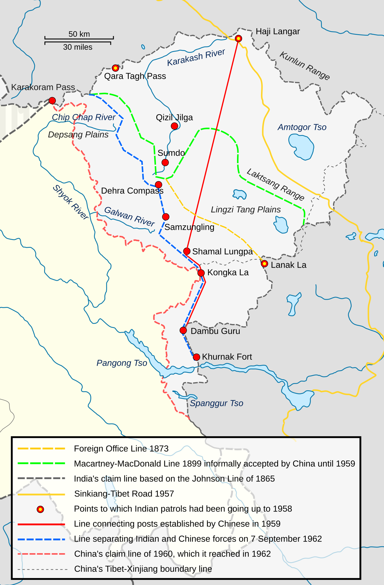
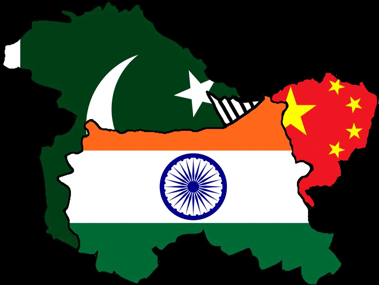
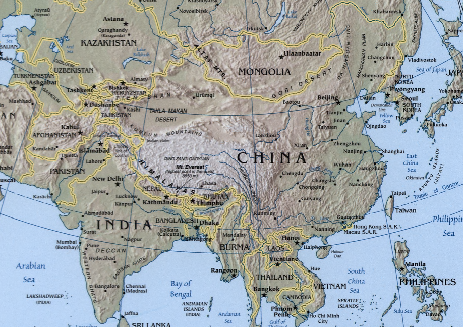
China and India shared a long border. India claimed it was 3,488 kilometers long, while China claimed a shorter one. Several disputed regions lie along this border. At the western end is the Aksai Chin region, about 38,000 square kilometers, which China claimed while India considered it part of Ladakh. At the eastern end, China claimed the North East Frontier Agency (NESA), about 90,000 square kilometers, which India administered. The border is mountainous and high. Aksai Chin is a cold desert at an average altitude of 5,000 meters, while NESA has hilly terrain with peaks over 5,000 meters. The fighting happened in these high-altitude, freezing conditions, which caused logistical and welfare problems for both armies. Many troops on both sides died from the cold.
**Background**
The main cause of the war was a dispute over sovereignty of the widely separated Aksai Chin and NESA border regions. India claimed Aksai Chin as part of Ladakh; China claimed it as part of Xinjiang. One trigger of the conflict was China building a road through the region to connect Tibet and Xinjiang.
**Aksai Chin**
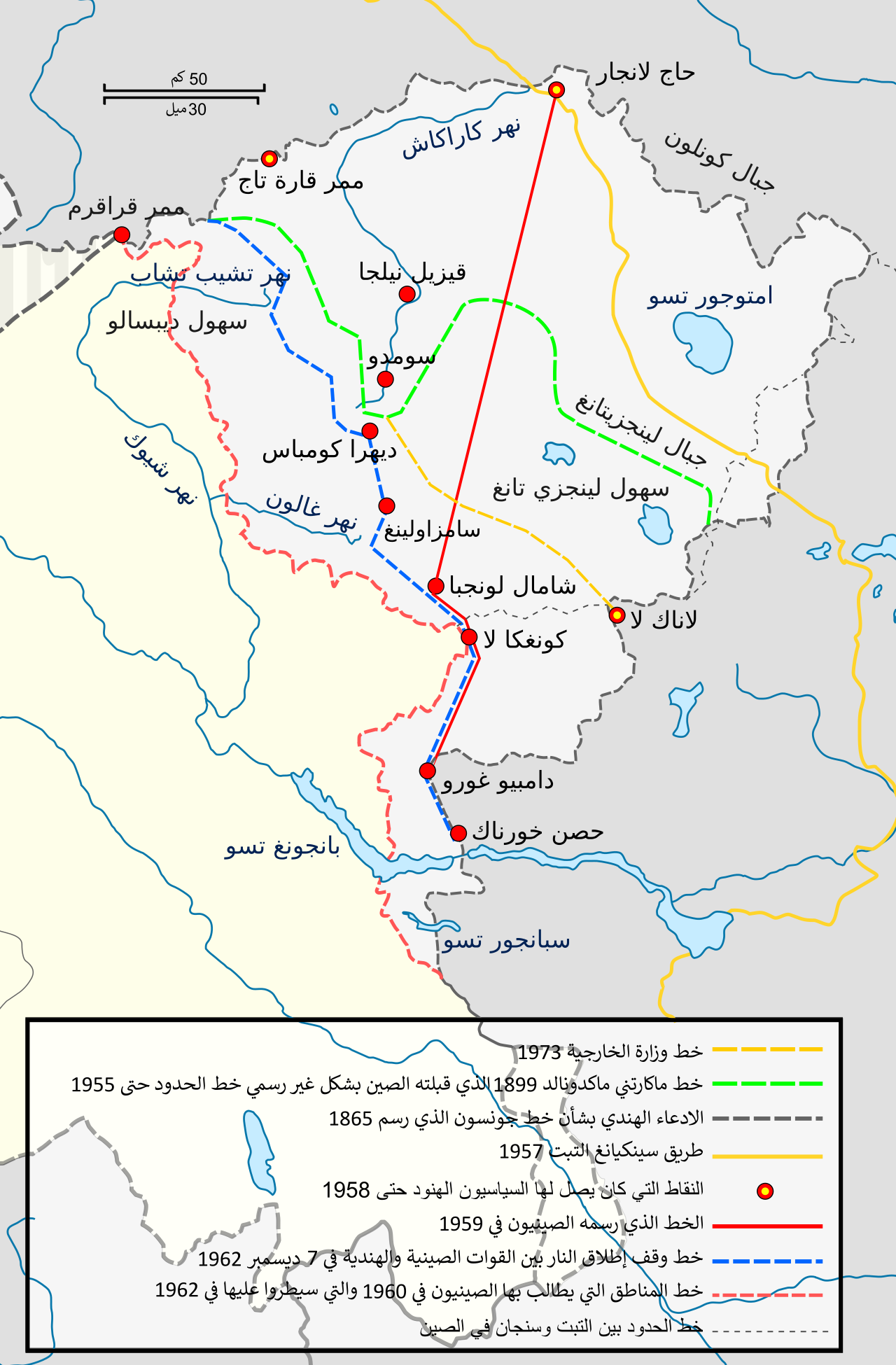
The western part of the border originated in 1834, when the armies of Raja Gulab Singh (Dogra), under the Sikh Empire, conquered Ladakh. After an unsuccessful campaign into Tibet, Gulab Singh and the Tibetans signed a treaty in 1842 agreeing to stick to “old, established frontiers,” but these were not specified. The British defeated the Sikhs in 1846 and took over Jammu and Kashmir, including Ladakh, installing Gulab Singh as Maharaja under their suzerainty. British commissioners tried to negotiate the border with Chinese officials, who showed no interest. The British fixed the southern end of the boundary at Pangong Lake but considered the area north of it to the Karakoram Pass as unknown territory. The Maharaja of Kashmir and his officials were aware of trade routes from Ladakh. From Leh, two main routes led into Central Asia: one through the Karakoram Pass to Shahidulla and on to Yarkand; the other went east through the Chang Chenmo Valley, across the Lingzi Tang Plains in Aksai Chin, and followed the Karakash River to join the first route at Shahidulla.
Lore & Background
The main cause of the war was a dispute over the sovereignty of the widely separated Aksai Chin and NESA border regions. Aksai Chin was claimed by India as belonging to Ladakh and by China to be a part of Xinjiang. China constructed a road through the region that connected the Chinese regions of Tibet and Xinjiang, which was one of the triggers of the conflict. The western portion of the Sino-Indian boundary originated in 1834, with the conquest of Ladakh by the armies of Raja Gulab Singh (Dogra) under the suzerainty of the Sikh Empire. Following an unsuccessful campaign into Tibet, Gulab Singh and the Tibetans signed a treaty in 1842 agreeing to stick to the "old, established frontiers", which were left unspecified. British commissioners fixed the southern end of the boundary at Pangong Lake, but regarded the area north of it till the Karakoram Pass as terra incognita. The Maharaja of Kashmir regarded Shahidulla as his northern outpost, in effect treating the Kunlun mountains as the boundary of his domains. After the 1862 Dungan Revolt, the Maharaja of Kashmir constructed a small fort at Shahidulla in 1864. W. H. Johnson of Survey of India was commissioned to survey the Aksai Chin region. The boundary of Kashmir that he drew, stretching from Sanju Pass to the eastern edge of Chang Chenmo Valley along the Kunlun mountains, is referred to as the "Johnson Line" (or "Ardagh-Johnson Line"). By 1892, the British settled on the policy that their preferred boundary for Kashmir was the "Indus watershed". A boundary alignment along this water-parting was defined by the Viceroy Lord Elgin and communicated to London. The British government proposed it to China via its envoy Sir Claude MacDonald in 1899. This boundary, which came to be called the Macartney–MacDonald Line, ceded to China the Aksai Chin plains in the northeast, and the Trans-Karakoram Tract in the north.
Reader's Guide
The conflict ended when China unilaterally declared a ceasefire on 20 November 1962 and simultaneously announced its withdrawal to its pre-war position, the effective China–India border. Much of the fighting consisted of mountain warfare, entailing large-scale combat at altitudes of over 5,000 m (16,000 ft). The war took place entirely on land, without the use of naval or air assets, and neither side officially declared a war, or broke off diplomatic relations. The conflict was viewed as a major military and political setback in India. In response, India rapidly modernised and expanded its armed forces, and strengthened border defences. India reassessed its policy towards China, and the conflict permanently damaged the Sino-Indian relations. As the Sino-Soviet split deepened, the Soviet Union supported India with the sale of military hardware, while India were also compelled to turn to the Soviets for military aid as the United States and the United Kingdom refused to sell them advanced weaponry. A series of border skirmishes arose between the two countries after the 1959 Tibetan uprising, when India granted asylum to the 14th Dalai Lama. Chinese military action grew increasingly aggressive after India rejected proposed Chinese diplomatic settlements throughout 1960–1962, with China resuming previously banned "forward patrols" in Ladakh after 30 April 1962. In September–October 1962, tensions escalated at Dhola Post and Thagla Ridge on the eastern front, where India interpreted the McMahon Line to run along the ridge, while China rejected this claim. A series of clashes ended with Chinese forces gaining the advantage, and by 18 October, China had amassed a large number of troops for a major offensive. China abandoned all attempts towards a peaceful resolution on 20 October 1962, and launched simultaneous offensives in NESA (eastern front) and Aksai Chin (western front). The Chinese forces overran the Indian Army positions at Namka Chu and Tawang in the eastern front, and Chip Chap Valley and Pangong Lake in the western front, after a heavy fighting and forced the Indian troops to withdraw. After a three week lull period, China resumed its offensive on 14 November 1962, and captured key positions at Se La, Bomdila, and Gurung Hill on the eastern front. In the western front, the fierce battles of Rezang La and Gurung Hill resulted in heavy casualties on both sides.
Did You Know?
- The fighting was concentrated in two locations along the India-China border, the North-East Frontier Agency (NESA) and the Aksai Chin region, which were roughly 1,000 km (620 mi) apart.
- China resumed previously banned 'forward patrols' in Ladakh after 30 April 1962.
- The conflict ended when China unilaterally declared a ceasefire on 20 November 1962 and simultaneously announced its withdrawal to its pre-war position.
- Neither side officially declared a war, or broke off diplomatic relations.
- The harsh conditions resulted in several casualties, with many troops on both sides succumbing to the cold temperatures.
The Contested Border and Its Historical Roots
The main cause of the war was a dispute over the sovereignty of the widely separated Aksai Chin and NESA border regions. Aksai Chin was claimed by India as belonging to Ladakh and by China to be a part of Xinjiang. The western portion of the Sino-Indian boundary originated in 1834, with the conquest of Ladakh by the armies of Raja Gulab Singh (Dogra) under the suzerainty of the Sikh Empire. Following an unsuccessful campaign into Tibet, Gulab Singh and the Tibetans signed a treaty in 1842 agreeing to stick to the "old, established frontiers", which were left unspecified. British commissioners fixed the southern end of the boundary at Pangong Lake, but regarded the area north of it till the Karakoram Pass as terra incognita. The Maharaja of Kashmir regarded Shahidulla as his northern outpost, in effect treating the Kunlun mountains as the boundary of his domains. After the 1862 Dungan Revolt, the Maharaja of Kashmir constructed a small fort at Shahidulla in 1864. W. H. Johnson of Survey of India was commissioned to survey the Aksai Chin region. The boundary of Kashmir that he drew, stretching from Sanju Pass to the eastern edge of Chang Chenmo Valley along the Kunlun mountains, is referred to as the "Johnson Line" (or "Ardagh-Johnson Line"). By 1892, the British settled on the policy that their preferred boundary for Kashmir was the "Indus watershed". A boundary alignment along this water-parting was defined by the Viceroy Lord Elgin and communicated to London. The British government proposed it to China via its envoy Sir Claude MacDonald in 1899. This boundary, which came to be called the Macartney–MacDonald Line, ceded to China the Aksai Chin plains in the northeast, and the Trans-Karakoram Tract in the north.
From Skirmishes to Full Offensive
A series of border skirmishes arose between the two countries after the 1959 Tibetan uprising, when India granted asylum to the 14th Dalai Lama. The border dispute was not resolved through bilateral talks, and China's construction of a strategic road through Aksai Chin further escalated the dispute. Chinese military action grew increasingly aggressive after India rejected proposed Chinese diplomatic settlements throughout 1960–1962, with China resuming previously banned "forward patrols" in Ladakh after 30 April 1962. In September–October 1962, tensions escalated at Dhola Post and Thagla Ridge on the eastern front, where India interpreted the McMahon Line to run along the ridge, while China rejected this claim. A series of clashes ended with Chinese forces gaining the advantage, and by 18 October, China had amassed a large number of troops for a major offensive. China abandoned all attempts towards a peaceful resolution on 20 October 1962, and launched simultaneous offensives in NESA (eastern front) and Aksai Chin (western front).
The Battles and the Nature of the Fighting
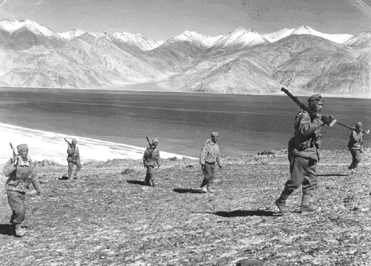
The Chinese forces overran the Indian Army positions at Namka Chu and Tawang in the eastern front, and Chip Chap Valley and Pangong Lake in the western front, after a heavy fighting and forced the Indian troops to withdraw. After a three week lull period, China resumed its offensive on 14 November 1962, and captured key positions at Se La, Bomdila, and Gurung Hill on the eastern front. In the western front, the fierce battles of Rezang La and Gurung Hill resulted in heavy casualties on both sides. Much of the fighting consisted of mountain warfare, entailing large-scale combat at altitudes of over 5,000 m (16,000 ft). The war took place entirely on land, without the use of naval or air assets, and neither side officially declared a war, or broke off diplomatic relations. The conflict happened in high altitude and freezing conditions, which caused logistic and welfare difficulties for the fighting armies. The harsh conditions also resulted in several casualties, with many troops on both sides succumbing to the cold temperatures.
Aftermath, Reassessment, and Shifting Alliances
The conflict ended when China unilaterally declared a ceasefire on 20 November 1962 and simultaneously announced its withdrawal to its pre-war position, the effective China–India border. The conflict was viewed as a major military and political setback in India. In response, India rapidly modernised and expanded its armed forces, and strengthened border defences. India reassessed its policy towards China, and the conflict permanently damaged the Sino-Indian relations. As the Sino-Soviet split deepened, the Soviet Union supported India with the sale of military hardware, while India were also compelled to turn to the Soviets for military aid as the United States and the United Kingdom refused to sell them advanced weaponry.
Gallery
Frequently Asked Questions
Where were the main battle zones of the Sino-Indian War?
Fighting was split across two regions roughly 1,500 to 2,000 kilometers apart: the Aksai Chin area in the west and the NEFA sector in the northeast. These corresponded to the two sets of disputed boundary lines each country claimed.
Why did the Sino-Indian War break out?
The root cause was a clash over territorial claims, with China building a strategic highway through Aksai Chin while India insisted on the Johnson Line and McMahon Line as the proper boundary. Each side rejected the other's interpretation of the border, and tensions escalated into open military confrontation.
More in Chinese History 1-24
Spotted an error? Know more?
This is a living reference — every entry is fact-audited, and reader corrections feed straight into our audit queue. Suggest an edit · See this site's audit record